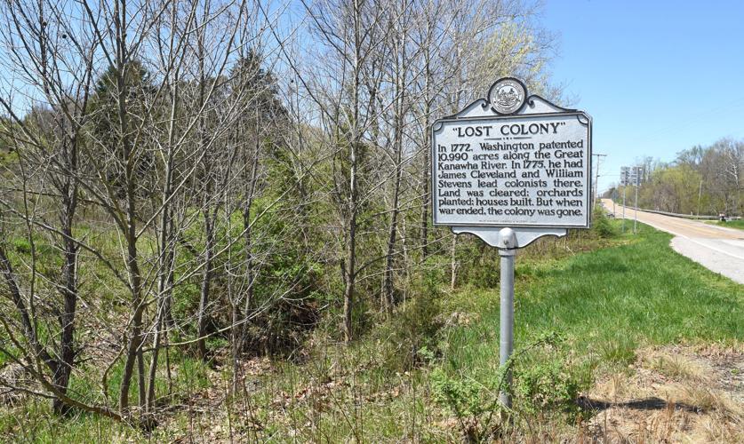
This sign along W.Va. 817 in Mason County, and seen here on Tuesday, April 8, 2025, points out to travelers that they are near where George Washington’s “Lost Colony” could have been located in 1770s.
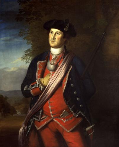
The earliest-known authenticated portrait of George Washington, painted by Charles Wilson Peale in 1772, shows the future Continental Army general and first U.S. president as a colonel in the Virginia militia during the French and Indian War in the 1750s. The paper in his waist pocket reads, “Order of March.”
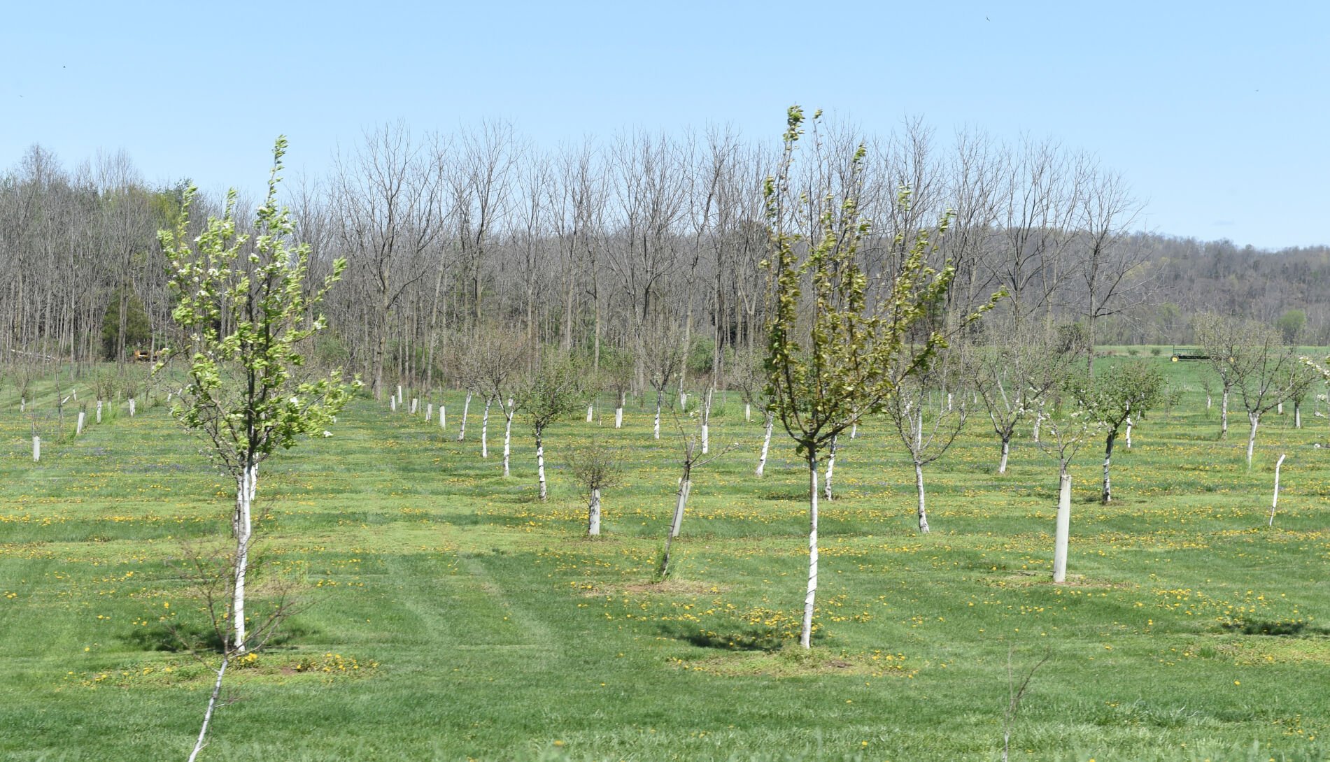
Fruit trees spring back to life on Tuesday, April 8, 2025, along W.Va. 817, also known as Kanawha Valley Road. The road follows the Kanawha River in Mason County near where George Washington’s “Lost Colony” might have been located in 1770s.
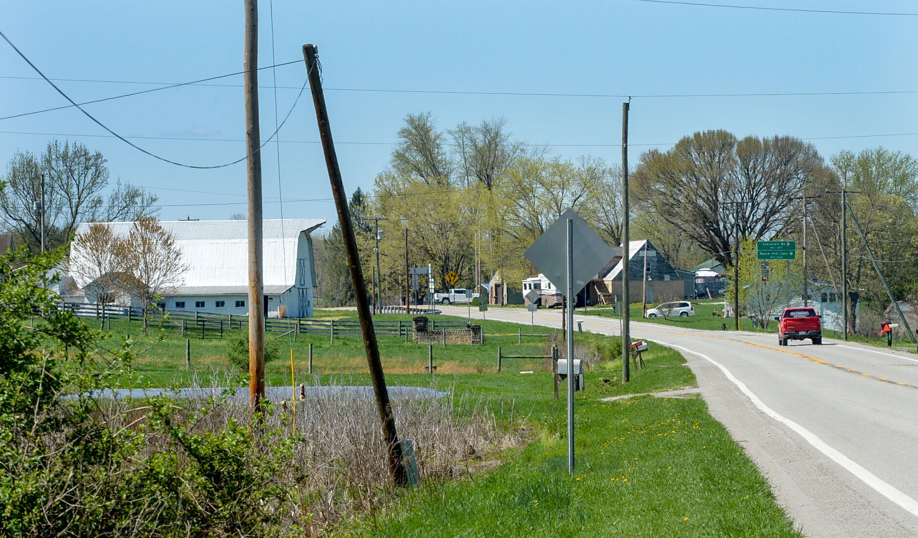
A barn and a house line W.Va. 817 in the Beech Hill area of Mason County on Tuesday, April 8, 2025. W.Va. 817 also is known as Kanawha Valley Road, which follows the Kanawha River in the vicinity of where George Washington’s “Lost Colony” might have been located in 1770s.
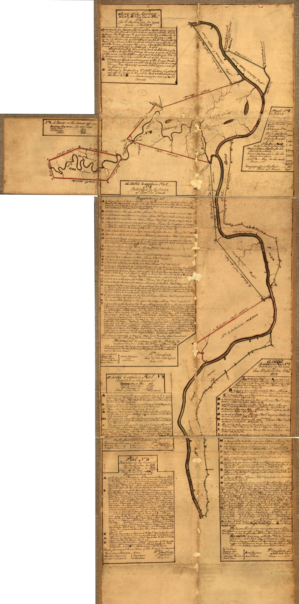
This map of George Washington’s Kanawha land includes a 10,990-acre tract in Mason County called the “Lost Colony.” The map was the result of a 1772 survey.
This sign along W.Va. 817 in Mason County, and seen here on Tuesday, April 8, 2025, points out to travelers that they are near where George Washington’s “Lost Colony” could have been located in 1770s.
CHRIS DORST | Gazette-Mail
The State of West Virginia's "Lost Colony" historic marker stands near a large, flat tract of cropland along the Kanawha River at the junction of the U.S. 35 Connector and Old U.S. 35 near Beech Hill in Mason County. It lists the basics of an enigmatic event that unfolded near the site 250 years ago:
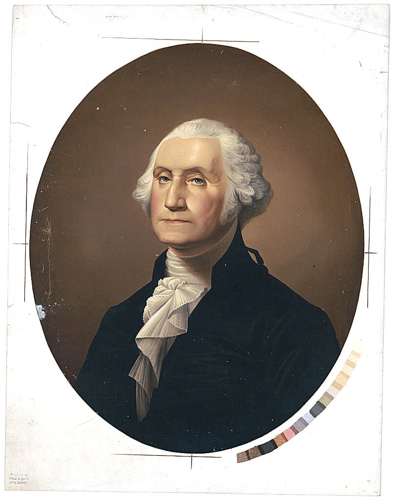
This portrait of President George Washington was painted between 1863-70 by James Fuller Queen.
LIBRARY OF CONGRESS | Courtesy photo
"In 1772, Washington patented 10,990 acres along the Great Kanawha River. In 1775, he had James Cleveland and William Stevens lead colonists there. Land was cleared, orchards planted, houses built. But when war ended, the colony was gone."
Some written accounts of the story incorrectly claim that no traces of the former colonists were ever found.
While the fate of George Washington's "Lost Colony" on the Kanawha may not be as mysterious as the roadside sign implies (spoiler alert: it was disbanded the same year it was created, more than seven years before the Revolutionary War ended), the settlement was an ambitious venture and a tale of perseverance over hardship. It led to Washington securing title to a 17-square-mile tract of bottomland prime for development and allowed him to entertain dreams of starting a real estate development, a peach orchard and a buffalo-breeding operation on his Kanawha Valley land.
'I set the hands to hewing and fixing'
This map of George Washington’s Kanawha land includes a 10,990-acre tract in Mason County called the “Lost Colony.” The map was the result of a 1772 survey.
LIBRARY OF CONGRESS | Courtesy photo
The story begins 250 years ago this month, when a party of about a dozen men beached their flotilla of six supply-laden canoes on the western bank of the Kanawha River in the middle of a 10,900-acre tract of riverfront bottomland claimed by George Washington.
Though weary from a month-long overland trek from eastern Virginia to western Pennsylvania, followed by two weeks of dawn-to-dusk paddling down the Ohio River and into the mouth of the Kanawha, the men who made up what later would be known as Washington's "Lost Colony" waded ashore.
And went straight to work.
"I set the hands to hewing and fixing, that no time might be lost," the party's leader, James Cleveland, wrote in a letter to Washington soon after the landing.
Rest was not an option for the travelers, most of whom were indentured servants from Scotland and Ireland. These men were bought and sold like slaves and forced to perform enough work to cover the costs of crossing the Atlantic before being freed from their terms of indenture to Washington.
Washington made it clear he expected nothing but hard work and disciplined behavior from the indentured men.
"If you should find any of the white servants obstinate and determined not to behave well," Washington wrote in his instructions to Cleveland, "I hereby give you full power and authority to sell and dispose of them to the best advantage."
A gift for Washington's service
Washington had been awarded the vast Kanawha River tract for his service as an officer in the Virginia militia during the French and Indian War, nearly 20 years earlier. He visited the site in 1770, while conducting a preliminary survey of the tract, and found it to his liking, for its abundance of both rich bottomland for farming and game for hunting.
After paddling 14 miles up the Kanawha from its mouth at present-day Point Pleasant, Washington set up camp "and went a hunting," he wrote in his journal for Nov. 2, 1770. "Killed 5 buffaloes and wounded some others, and three deer. This country abounds in buffaloe and wild game of all kinds," he wrote, including "swans, geese and ducks of all kinds."
In 1772, after having the tract officially surveyed, Washington applied for a patent, or legal title to the property. That gave him three years, or until the end of 1775, to either make significant improvements to the tract or surrender his patent application.
With the clock ticking, in January 1775, Washington began sending food, seed, building supplies and tools to his western land agent — William Crawford who lived in the Pittsburgh area — to prepare for shipment down the Ohio River to his Kanawha River tract.
At the same time, Washington began acquiring a crew of newly landed indentured servants to begin work on a farming settlement on his Kanawha River tract. He sent them westward on March 7, 1775, with plans to meet them at the site in May.
But on April 19, 1775 — two days before Cleveland's party set foot on the Kanawha shoreline — shots rang out at Lexington and Concord in Massachusetts, marking the start of the Revolutionary War. Within two months, Washington was named commander of the Continental Army, and his plans to visit his Kanawha River settlement were permanently shelved.
Fruit trees spring back to life on Tuesday, April 8, 2025, along W.Va. 817, also known as Kanawha Valley Road. The road follows the Kanawha River in Mason County near where George Washington’s “Lost Colony” might have been located in 1770s.
CHRIS DORST | Gazette-Mail
The long, narrow tract where the settlement was to be located stretched southward for nearly 17 miles along the west bank of the Kanawha, starting from a point about two miles south of the river's confluence with the Ohio, and ending near the present Mason-Putnam County border. It included the sites of present-day Beech Hill and Southside.
Washington's pre-Revolutionary War holdings along the Kanawha also included a 12-mile-long, 7,276-acre tract along the eastern shore of the Kanawha stretching northward from present-day Poca. Washington acquired more than 23,000 acres along the Kanawha River before his death.
Washington's plan was to populate his Kanawha River holdings with settlers — including indentured servants who would become his tenant farmers after working off their trans-Atlantic passage costs.
In a paid notice in the Aug. 20, 1773, Baltimore Advertiser, Washington displayed his real estate promotional skills. He pitched his Kanawha River and Ohio River lands as being second to none "in luxuriance of soil or convenience of situation...abounding with fine fish and wild fowl of various kinds, and also in most excellent meadows, many of them, in their present state, are almost fit for the scythe."
Washington pledged to divide tracts of his holdings into "any sized tenements that may be desired and lease them upon moderate terms, allowing a reasonable number of years rent free," providing tenant farmers cleared, fenced and tilled at least three acres of every 50-acre lot within two years.
Manifest Destiny, and a long to-do list
The Kanawha River settlement was apparently planned to serve as a model community, to prime the pump for Washington's new western real estate venture while proving to future settlers that the area was now safe from Indian raiders following the Virginia Militia's victory at the Battle of Point Pleasant during the previous year.
The earliest-known authenticated portrait of George Washington, painted by Charles Wilson Peale in 1772, shows the future Continental Army general and first U.S. president as a colonel in the Virginia militia during the French and Indian War in the 1750s. The paper in his waist pocket reads, “Order of March.”
WASHINGTON AND LEE UNIVERSITY | Courtesy photo
While Washington never returned to the site of his planned settlement for the duration of the war, his presence was surely felt by Cleveland — who previously served as a hunting dog handler — teamster and tenant farmer at Washington's Mount Vernon estate, and William Stevens, Washington's western lands manager. Letters sent to both men contained long, detailed instructions on how Washington thought the settlement should take shape:
"Soon as you have pitched upon the spot to begin your improvements, use every diligence in your power to get as much land as possible ready for corn, and continue planting, even with the rare ripe corn, as long as you think it shall have time to come to perfection," Washington instructed Stevens.
"You may, in the meanwhile be putting up houses for the convenience of yourselves to live," Washington continued, "but do not spend any time in fencing in the field until it is too late to plant" all available seed corn.
Washington sent similar instructions for planting potatoes, peas, turnips and peaches, topped off with what must have been an unexpected request:
"After you have got a place enclosed, buy me all the buffaloe calves you can get and make them as gentle as possible...as I am very anxious to raise a breed of them," apparently for use as draft animals, Washington wrote in a letter to Cleveland.
Troubles from the start
But the realities of frontier life soon conflicted with implementing Washington's lofty plans for developing the settlement.
Four days after landing on Washington's Kanawha River tract and beginning the work of clearing and planting, two of the indentured servants fled in a canoe, and were brought back by Cleveland the following night — only to have five more run off within a matter of hours.
"The time I lose (retrieving the servants) is more than they are worth," Cleveland lamented in a letter to Washington. "I have the poorest set of hands that I ever saw. I am building a house to lock them in at nights as there is no other way to keep them until you can come out to see what is to be done with them."
To make matters worse, "at this time we have but 28 bushels of corn, our meat is all gone, game is scarce, and the fish will not bite or there is none to bite," Cleveland complained.
Abandoning the settlement
Despite the hardships, Cleveland and his crew persevered.
By the fall of 1775, the crew had cleared 23 acres on the Kanawha River tract, and planted on that land crops of corn, potatoes and turnips, along with 2,000 peach pits, according to an affidavit Cleveland filed in the county court of Fincastle County, Virginia, which then encompassed the land.
The affidavit also listed three 40'x16' two-story "dwelling houses," 10 "cabbins," and a small barn with attached stables as having been built at the site. In all, the improvements were valued at 1,100 pounds, 15 shillings and 7.5 pence, and were ordered to be "recorded according to law."
Cleveland listed those achievements in a Nov. 16, 1775, letter to Washington, written as he was in the process of abandoning the settlement, after a militia garrison abandoned Fort Blair at Point Pleasant that summer and the fort was torched by Native Americans. At the same time, warnings of an impending Indian uprising in the Ohio Valley began to filter in from Fort Pitt in Pittsburgh and Fort Henry in Wheeling.
Cleveland also let Washington know that all the settlement's remaining tools, nails, gunpowder and lead had been stored in kegs and taken to Fort Henry "and will be delivered when called for."
As to the indentured servants, Cleveland wrote that two drowned, one escaped and avoided recapture, and six had been sold for between 24 pounds and 28 pounds, five shillings, in Virginia currency, each. The remaining indentured servant, Cleveland wrote, "behaved himself so bad I could not get a price for him, so I was forced to take a rifle gun and 40 shillings" in trade for him.
At least two of Washington's Black slaves also helped establish the settlement. Cleveland wrote that he left them with Col. William Crawford, Washington's friend and western land agent, near present-day Connellsville, Pennsylvania, after abandoning the Kanawha tract.
The last of Washington's party to lay eyes on the Kanawha River settlement apparently were William Stevens and William Skilling, who helped guide Washington's servants and slaves to the site. They had been tasked by Cleveland with harvesting the corn, potatoes and turnips that had been grown on the Kanawha River acreage and transporting them to Fort Henry.
But when the two returned to the settlement a short time after Cleveland and his party of servants and slaves abandoned it, they "found the buildings all burned down," apparently by Indians, according to a Dec. 23, 1775, letter Lund Washington — George Washington's cousin — wrote to the future first U.S. president, sent days after Stevens and Skilling arrived back at Mount Vernon.
Stevens and Skilling told Lund Washington, who was running the Mount Vernon estate in his cousin's absence, that they had "dug about 70 bushels of potatoes and buried them," but the remaining corn was left on the stalks, "not knowing what to do with it and having no tools to build a house to put it in."
Stevens and Skilling "think the lands are very fine," Lund Washington reported to his cousin.
A barn and a house line W.Va. 817 in the Beech Hill area of Mason County on Tuesday, April 8, 2025. W.Va. 817 also is known as Kanawha Valley Road, which follows the Kanawha River in the vicinity of where George Washington’s “Lost Colony” might have been located in 1770s.
CHRIS DORST | Gazette-Mail
By the time of his death in 1799, Washington had acquired or been awarded land grants totaling more than 23,000 acres along the Kanawha River in Kanawha, Putnam and Mason counties, including land that now embraces the cities of Dunbar and St. Albans.
Washington unsuccessfully sought to sell or lease his Kanawha River tracts through the 1780s and 1790s. His Kanawha River holdings continued to be offered for sale after his death and into the early 1800s. But in time, the land was passed on to various nephews, nieces or their children, some of whom moved west to take possession of their inheritances.
Washington may have been thinking of his Kanawha holdings while writing a 1794 letter to former Revolutionary War officer Presley Neville of Winchester, Virginia:
"From the experience of many years, I have found distant property in land more pregnant of perplexities than profit," Washington wrote.
While Cleveland selected a site he determined to be the midpoint of Washington's 17-mile-long Kanawha River tract as the locale for the settlement, its precise location is unknown, and remnants have never been found.
CLICK HERE to follow the �������� Gazette-Mail and receive